Weaving Public Health into Projects in Coaldale, Alberta

Written by Kim Perrotta

Background

In 2018, the Town of Coaldale, Alberta, began thinking about how it might bring health considerations into new projects to create a healthier community. 

The town, which has a population of 9,000 people, has made considerable advances in the built environment including a new multi-use recreation centre designed to accommodate a variety of community programming opportunities, while expanding its multi-user trails by approximately four kilometres over the past four years. 

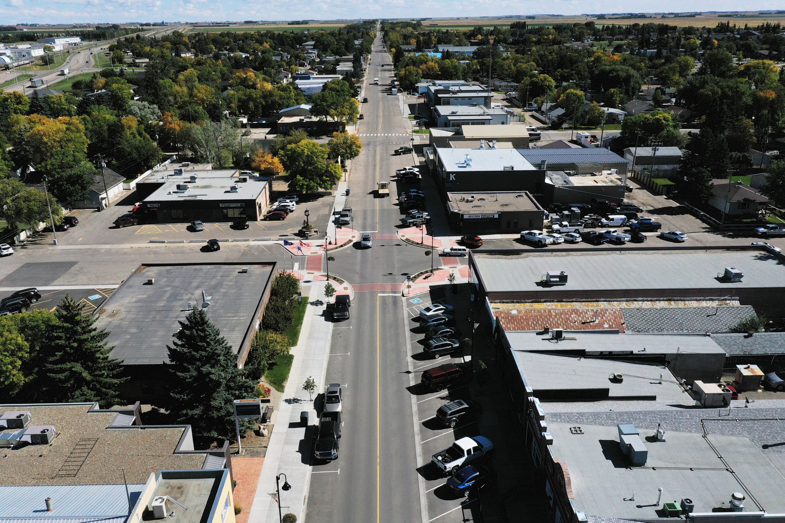
“We have a young population. The average age is 36 and there are a lot of children in town. So recreational facilities and cycling paths are in high demand,” said Spencer Croil, Director of Planning and Development and Deputy Chief Administrative Officer of the town.  “We used the revitalization of the downtown core as an opportunity to encourage walking and cycling. Main Street extends only four blocks but it is a gathering point for everyone in the community. So, we worked to ensure that those blocks were built to a human scale that would make it a comfortable space to walk, gather and recreate,” said Spencer.

Process 

As part of the Town’s commitment to support the ongoing health needs of the community, in early 2021, it partnered with two divisions of Alberta Health Services to initiate a pilot program called Healthy Communities by Design.  

“Using Alberta Health Services’ Healthy Places Action Tool, we engaged the community through a Healthy Communities Working Group to assess the town in six health-related areas, including opportunities for physical activity, healthy eating, reduced alcohol and tobacco use, UV (ultraviolet) protection, and cancer screening,” said Melanie Messier, a Planner with the Town

“We received valuable feedback from the working group that was comprised of town councillors, school representatives, the town’s parks and recreation departments, the public library, a local business owner, and representatives from the Family and Community Support Services (FCSS) program,” said Melanie.

Outcomes 

The working group and report prepared by Alberta Health Services concluded that Coaldale was well-served with recreational facilities but could do more to support healthy eating and cancer screening. One in ten households in Alberta experience challenges in accessing healthy food options.

“A natural next step for us was to weave these findings into a variety of major projects and programs that are in development in town,” said Melanie. “We are also using them to begin drafting a Healthy Communities Strategic Plan.”  

The Strategic Plan is also being developed with a consideration of community health. Inspired by the Conference Board of Canada’s Community Wellbeing Framework, the Town will use it as the basis for conversations on future developments intended to address the priority areas identified by the residents. 

Having identified areas of improvement, residents are getting involved in proposing solutions to address the priority areas. For example, the Town is currently working with local Kate Andrews High School students who are developing proposals for a Community Improvement Project

“Students have been given an $8,000 budget based on grant funding to develop their proposals in either one or more of the health-related topic areas” said Melanie “One of the proposals that we plan to act on is the establishment of a Farmer’s Market on the newly revitalized Main Street.”  

Beyond providing more opportunities for healthy eating, farmer’s markets also provide health and social co-benefits. They promote social connection and community cohesion, while also providing opportunities for community members to get outside and walk around. 
The Long Road to Complete Streets in Hamilton

Written by Kim Perrotta

Back in 2011 and 2012, the City of Hamilton started community discussions about “complete streets” when it organized a transportation summit on the topic with the non-profit organization, Share the Road.  A commitment to develop “complete streets” was adopted several years later in the City’s 2018 Transportation Master Plan.

“Complete streets is an approach to road design that balances the needs of people of all ages and abilities and all modes of transportation in an equitable manner,” offered Trevor Jenkins, Project Manager in Sustainable Mobility Planning at the City of Hamilton. “It represents a shift from historical approaches to street design that were focused primarily on motorized vehicles.” 

The Process

The 2018 Transportation Master Plan committed the City to develop a Complete, Livable, Better (CLB) Streets Design Manual that could be used to operationalize the commitment to complete streets.

“By 2015 when the city began work on the Transportation Master Plan, there was no longer any question about whether we should develop complete streets. By then, people recognized that complete streets offer so many public health, environmental and social benefits,” offered Trevor. “Complete streets are safer for all travellers. They foster health by encouraging physical activity. They reduce air pollution, climate emissions and traffic congestion. And they are more equitable and increase community resiliency by providing more options.” 

In 2019, City staff turned their attention to operationalizing complete streets – trying to figure out how to make it happen. They spent two years identifying and classifying the different types of streets in Hamilton and examining the designs being recommended for each type of street by other organizations and communities that are aiming to create complete streets. 

“There is a lot to consider when re-designing streets. There are water and wastewater pipes, electrical lines, and other utilities under and around streets,” explained Trevor. “We have to work around this infrastructure while considering how to accommodate the different modes of transportation, trees, snow storage, pedestrian furniture, bike racks and transit shelters. There is limited space to work with and the needs for each will vary depending on the local context.”

The Outcome

The work of city staff since 2019 is reflected in a report that was approved by City Council in January 2021 entitled, Complete, Livable, Better Streets – Policy and Framework. This report identifies the different types of streets in Hamilton – urban avenues, transitioning avenues, main streets, connectors, neighbourhood streets, industrial roads, rural roads, and rural villages – and proposes designs or “streetscape elements” for each.  

The list of streetscape elements includes the pedestrian realm and placemaking, cycling facilities and transit facilities, motor vehicle lanes, green infrastructure, and utilities and municipal services. The report also includes policies and examples to help staff decide how to re-design a street that is being renewed or rebuilt. 

The public is now being consulted on these designs with a detailed survey that seeks feedback on each of the designs proposed for each of the seven types of streets. Staff plan to bring the final recommendations to City Council in the spring of 2022.  

“We have already begun renewing streets across Hamilton. For example, bike lanes separated by posts have been installed along Cannon Street in the downtown core. On Hatt Street in the west end of Hamilton (in Dundas), we have installed bike lanes protected by concrete barriers and parked cars,” said Trevor. “And, when we re-surfaced the Claremont Trail, that joins the lower side of the City to the neighbourhoods on the top of the escarpment, we installed a 2.1 km multi-use path that is separated from the road by a 1.4 m concrete and aluminum barrier so pedestrians and cyclists can safely travel directly up the escarpment.” 

The community has responded positively to these changes and there has been good pick-up by cyclists and pedestrians. The number of cyclists using Cannon Street has increased from 30 per day in 2013, before the separated bike lanes were installed, to 390 per day in 2014 one year after their installation, to 660 per day in 2021.  With the re-surfaced Claremont Trail, active travellers have increased from one dozen cyclists and pedestrians per day before the installation of the multi-use path called the Keddy Trail, to an average of 620 cyclists and pedestrians per day since its installation. 

Once the street designs and policies are approved by City Council, they will be applied to all streets in the City as each one comes up for renewal.  

“Streets last 25 to 50 years so this is a long-term process that will gradually transform our city,” notes Trevor. “Complete streets generally do not cost more than regular streets. It is about doing things differently when a street is renewed or rebuilt.”

Fostering Physical Activity in Glace Bay, Nova Scotia

Written by Kim Perrotta

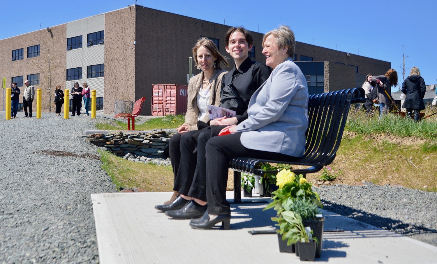
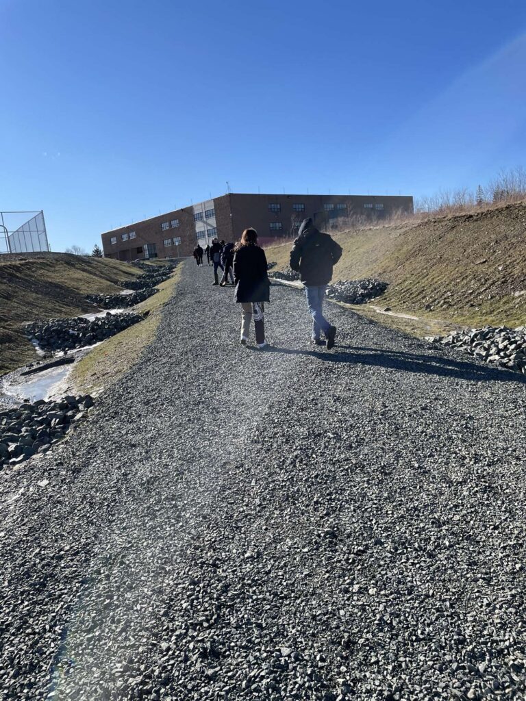
In 2019, the students in Glace Bay, Nova Scotia, organized for two years to have a new pedestrian pathway built in their community that will connect their high school to local businesses in town and encourage others in the town of 19,000 to increase their levels of physical activity.

“The former path, which students jokingly called ‘the Burr,’ was used unofficially by about 600 of the 800 students in our school,” explained Daniel MacGillivary, high school student and the Co-Executive of the Glace Bay High Change Makers Burr Group. “It was a very steep path that crossed a treacherous waterway. Students were not supposed to use it, but many did because it made it possible to reach local businesses during their lunch hour.”

Process

The project, called “Building Burr-idges; A Safe and Walkable Youth-led Pedestrian Pathway”, received strategic advice and support from staff at the Ecology Action Centre and Nova Scotia Public Health Services. The students also rallied support from community partners, local businesses, the school’s advisory committee and operations staff, Members of Parliament, and Members of the Legislative Assembly, to secure the trail easements, agreements, and funding needed to complete the project.

“The new pedestrian pathway and bridge – which will be accessible to everyone – is only 150 metres long, but it can fill a number of the community’s needs,” noted Stephanie Johnstone-Laurette from the Ecology Action Centre. “It will provide the students with a safe and convenient route to local businesses. It creates a potential walking loop that can be used by people in town to increase their levels of physical activity; something that is important in a rural community where recreational facilities are scarce. And it could also be used to connect with other recreational initiatives such as the Coal Town Trail, a new multi-use recreational trail network that follows an old railway line that has some historical significance for the town.”
The group worked to include positive amenities such as signage focused on mental health advocacy, two permanent benches, bike racks, and a picnic table for the public to use when the path opens in 2022.

“A key focus of this project was to re-create a public space” noted Daniel. “We wanted to create a public space that the community can take pride in; to provide a positive legacy for future students in Glace Bay.”     

Outcome

Funding for this project has been secured from several departments within the provincial and federal governments.

“The students did a great job organizing around this issue. They ultimately succeeded in gaining nearly $200,000 in infrastructure for their town,” Stephanie said. “And they have actually won three community awards for their dedicated work on this project.”

Holding the Line in Hamilton

Written by Kim Perrotta

Background

Late in 2021, the City of Hamilton voted to create a hard urban boundary for the city and became a leader in sustainable urban planning in Ontario. Much of the credit for that decision goes to community groups that engaged residents around the issue.

“Under the former provincial government, we had several planning strategies and policies in place in Ontario that were designed to curb urban sprawl and protect farmland and greenspace in the Greater Toronto & Hamilton Area (GTHA),” explained Lynda Lukasik, Executive Director of the non-profit organization, Environment Hamilton. “Those guidelines encouraged, sometimes even mandated, the development of complete communities that are walkable, bikeable and transit-supportive. But that has changed over the last few years. Our current provincial government has loosened many of the policies that were designed to control urban sprawl. For example, in Hamilton, the province has reduced minimum requirements for intensification, undoing policies designed to phase in more stringent targets over time.”

The Challenge

Working under the “loosened” provincial policies, the City of Hamilton tabled a proposal for development in the city out to 2051. This new proposal assessed the amount of land the city would need to accommodate the population growth it expected to see over the next 30 years. Assuming development patterns from the last 20 years would continue, the city projected that it would need to develop more than 3,000 acres of prime farmland surrounding the areas currently developed in the city.

“We challenged these projections because they are based on outdated development patterns and population preferences. The assessment does not reflect the changing attitudes of the population; that older people in our community are now looking to downsize within their community, while young adults are looking for a more urban lifestyle that supports active modes of transportation such as cycling,” offered Lynda. “Nor does this projection reflect the actions that are needed in the face of the climate crisis; the need to preserve prime farmland; the need for transit-supportive development that reduces climate emissions from the transportation sector.”

The Process

Environment Hamilton organized several webinars to engage Hamilton residents on the issue of the city’s urban boundary. Calling their webinars “Will Sprawl take it All?” and “Don’t Let Sprawl take it All”, they were surprised by the number of people who showed up and their passionate response to the issue.

“A huge number of people participated in our webinars and a new grassroots organization popped up calling itself, StopSprawl HamOnt,” noted Lynda. “People seemed most concerned about the loss of farmland and what that means for food security in the face of the climate crisis. This goes for the farming community as well. Local farmers and their organizations have also expressed strong support for a hard urban boundary.” 

The community groups began engaging the public in one-on-one meetings, on social media, and in webinars. StopSprawl HamOnt set up an on-line tool to allow residents to communicate directly with their City Councillors. They provided residents with “Stop Sprawl” lawn signs and placed ads on the radio. They encouraged residents to let their councillors know about their concerns. Environment Hamilton organized webinars for the public on the delegation process. 
“We explained the delegation process to residents,” said Lynda. “We helped them to understand how they could make a submission in writing or in person to the council meeting and provided tips about how to prepare an effective submission or presentation.” 

The Outcome

In March 2021, City Council responded to the calls from residents by instructing staff to send out a household survey on the issue. The survey was disseminated in hard form by the City. StopSprawl HamOnt made the survey available to residents with an on-line survey tool as well. In the end, the survey was completed by about 18,000 residents – more than 2% of Hamilton’s population. Ninety per cent of respondents supported the option of a “firm urban boundary” and strong support was expressed by residents from all wards across the city.    

When the question of the urban boundary came up at City Council in November 2021, about 120 people provided written submissions to Council and another 60 presented directly at the council meeting.  At that meeting, Hamilton City Council voted to hold a hard urban boundary in Hamilton out to 2051.

“City staff have now prepared a draft proposal on how to meet growth within the existing boundaries.  We will be looking at those proposals carefully. There will be a desire to increase densities around major transit stops and along corridors, such as the new Light Rail Transit (LRT) route, to make good use of efficient transit service. But we will also want to look for innovative ways to ‘create the missing middle’ – to produce neighbourhoods with moderate levels of density that are more walkable, bikeable and supportive of transit,” explained Lynda. “Our goal is to create a healthier, climate resilient, and equitable community. The hard urban boundary will help us to achieve that.”

Public Health and Planning Collaborate to Create 15-Minute City in Ottawa

Written by Kim Perrotta

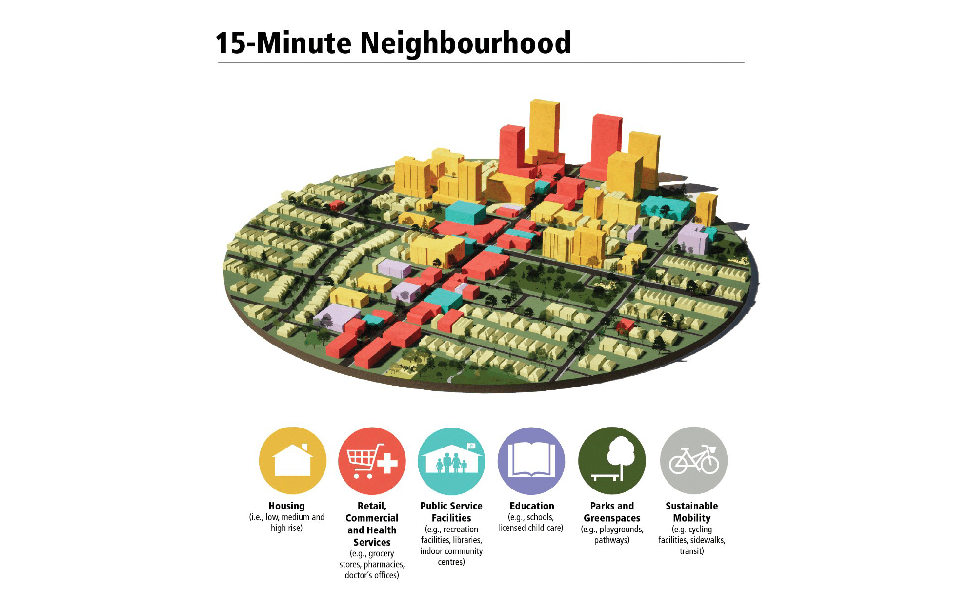
Ottawa has become one of the first communities in Canada, perhaps in North America, to enshrine the 15-minute neighbourhood in its Official Plan.

“In Ottawa Public Health (OPH), our goal was to have the City’s new Official Plan built on a framework that creates communities that are healthy, inclusive, sustainable and resilient,” offers Inge Roosendaal, Healthy Communities Planner with Ottawa Public Health. “We were using our ‘Five C’s – compact, connected, convivial, complete and cool’ to describe our vision of neighbourhoods that would support these goals, but found we needed a more cohesive concept to communicate to the public and planners. So, we pitched the idea of the ‘15-minute neighbourhood’ and it resonated` with our communities.”  

Process

The concept of the 15-minute neighbourhood was captured in a high-level policy directions report called the “5 Big Moves” that was approved by Ottawa City Council in September 2019 and it became a framework around which the Official Plan was built.

To meet its goals, Ottawa Public Health  co-located two of its staff to the Planning Department for the three years that it took to develop the new Official Plan.

“It was seminal to the achievement of public health’s goals that public health staff were assigned to work with the Planning Department for the duration of the process. In the past, we were participants who were consulted.  This time, we collaborated as fully engaged partners at every stage of the Official Plan process,” explained Inge. “This gave us the time to engage in many conversations with our colleagues in other departments. It allowed us to pull together the health evidence needed to support the policies we were promoting. We prepared one of the background papers that informed the development of the Official Plan – called “Healthy Ottawa by Design.”  And we subsequently informed the discussions for the many sections the Official Plan.”

It was actually helpful that we were engaging in this process during the COVID-19 pandemic because Ottawa residents – who were in lockdown for some of the time – were really feeling the impact that their neighbourhoods have on their lives,” noted Birgit Isernhagen, Program Planning and Evaluation Officer in Ottawa Public Health. “Those who lived in well-designed neighbourhoods could walk and cycle, access essential services, and enjoy parks and green space, while those who lived in poorly designed neighbourhoods were really feeling the effects of isolation on their physical and mental health. We started referring to the ‘15-minute neighbourhood’ as a pandemic-resilient neighbourhood and that resonated with the public.”        

Outcomes

Approved by City Council in November 2021, the new Official Plan will guide development in Ottawa for the next 25 years – until 2046. It identifies five broad policy directions as “the foundation to becoming the most livable mid-sized city in North America over the next century.”  Those policies articulate the need to:

  • Accommodate more growth by intensification of existing neighbourhoods rather than by greenfield development;
  • Ensure that the majority of trips in 2046 will be made by sustainable modes of transportation such as walking, cycling, transit or carpooling;
  • Use sophisticated urban and community design principles to create stronger, more inclusive and vibrant neighbourhoods and villages that also reflect and integrate Ottawa’s economic, racial and gender diversity;
  • Embed environmental, climate and health resiliency and energy into the framework of planning policies to support walkable 15-minute neighbourhoods with a diverse mix of land uses, and mature trees, greenspaces and pathways, that help the City achieve its net zero climate commitment for 2050, its 40% urban forest canopy cover target, and increase the City’s resiliency to the effects of climate change.
  • Embed economic development into the framework of the planning policies.

The Official Plan identifies six cross-cutting strategic policy directions that are advanced through implementation policies in multiple sections of the Plan. The Healthy and Inclusive Communities, the Climate Change and Energy, and Gender and Racial Equity policies are included in this list.

“While the broad Healthy and Inclusive Communities policies address sustainability, health equity, the need for age-friendly and inclusive communities, the cornerstone framework that pulls these elements together is the 15-minute neighbourhood” explains Inge. “We describe the 15-minute neighbourhood through policy as one that is well-connected to a diverse mix of land uses, includes a range of housing types and affordabilities, provides easy access to shops, services, schools and childcare, employment, greenspaces, parks and pathways, and is well serviced by active transportation and transit.”

“Public health staff were not responsible for developing the broad Climate Change and Energy policies, but we worked closely with our Planning colleagues to ensure that the Official Plan policies addressed the actions needed to increase community resiliency and protect the public from the impacts of the changing climate,” offered Birgit. “For example, it includes commitments to reduce the urban heat island effect, improve access to shade, preserve nature, support community gardens and food production, and enable active transportation, transit use and outdoor recreation in all weather conditions. It also notes the need to employ an equity and inclusion lens when implementing climate policies.”

Specific recommendations for these cross-cutting policies have been integrated throughout the Official Plan to ensure that the strategic goals are actually implemented. They will also be supported by other policies and plans that have been, or will be, developed by the City. For example, in September 2021, the City released a 15-Minute Neighbourhoods Baseline Report that analyses existing neighbourhoods across Ottawa against the criteria for the 15-minute neighbourhood and identifies the next steps for implementing the policy goals enshrined in the Official Plan.

All images courtesy of Ottawa Public Health.

Creating Healthy, Age-Friendly Communities in Rural Canada-Grey County

Written by Kim Perrotta

Tucked under the scenic southern shore of Georgian Bay in Ontario, Grey County is home to nearly 100,000 people who live in dispersed housing across 4,500 square kilometres of rural areas and small urban centres. Owen Sound, with a population of 22,000 people, is the County’s largest urban centre. 

“About 10 years ago, the Health Unit began cultivating relationships with our municipal partners, in particular the Planning Departments in Grey and Bruce Counties, because our counties have high rates of obesity and chronic disease. For example, the rate of cardiovascular disease deaths is 27% higher in Grey and Bruce Counties than the provincial average,” said Jason Weppler, Program Manager, Chronic Disease and Injury Prevention, Grey Bruce Health Unit. “To some extent, these health statistics reflect the fact that both rural counties have older populations.” 

About 24% of the people in Grey and Bruce Counties are over 65 compared with 17% of Ontarians. And that difference is not expected to change over the next 20 years. But other factors also contribute to higher rates of chronic disease. 

“With no transit, dispersed housing, and small urban centres that were not developed with “walkability” in mind, people in these counties have had fewer opportunities to maintain the levels of physical activity needed for good health. These are issues that can only be addressed by looking at how we design and develop our communities,” Weppler said.

In light of these trends, the County and Health Unit have been collaborating to create healthy, age-friendly communities. In the early years, the planners and public health professionals worked to understand one another’s goals and processes. More recently, they have cultivated relationships with engineers and developers in the County, particularly around issues related to transportation systems.  

“As Planners, we don’t necessarily have training in the social and environmental indicators of health so we didn’t understand how community design might influence physical and mental health in our communities. It has been helpful to work with the health unit to understand their goals and to get their help shaping our policies,” offers Scott Taylor, Manager of Planning Services, Grey County. “It has been particularly useful that these conversations are also happening at all levels of staff in our organizations and at the Board of Health where the Medical Officer of Health has been working to educate the mayors and deputy mayors about the links between community design and public health.” 

Grey County’s new Official Plan, approved by the Province in 2019, reflects the inter-sectoral collaboration that has occurred in Grey County. It includes a number of over-arching policies, and many very specific policies, that aim to encourage the development of age-friendly, healthy communities. It identifies the need to promote active transportation infrastructure including pedestrian furniture, safe and accessible public open spaces, access to green space, access to healthy affordable local foods, and development for all ages and abilities, and residential intensification, while limiting exposure to environmental hazards. 

To achieve these goals, the Official Plan commits the County to considering a wide variety of transportation modes when designing its roads. It indicates, for example, that the County will consider paved shoulders for all County roads to support cyclists and other alternate modes of travel. It also considers the connection of existing and future trails, sidewalks, and paved shoulders throughout the County, acknowledging the health benefits of a connected active transportation network.

Wanting to see these recommendations implemented in each new build, the two Counties and the Health Unit provide a Healthy Development Checklist to developers at the front end of the development process so they can integrate healthy community designs into their projects. It recommends supporting mixed land use by integrating a variety of residential development within 800 metres of retail, recreational centres, parks and public spaces; preserving urban forests and dedicating no less than 5% of the total proposed land area to outdoor public spaces; and designing neighbourhood blocks that are less than 250 meters in length.

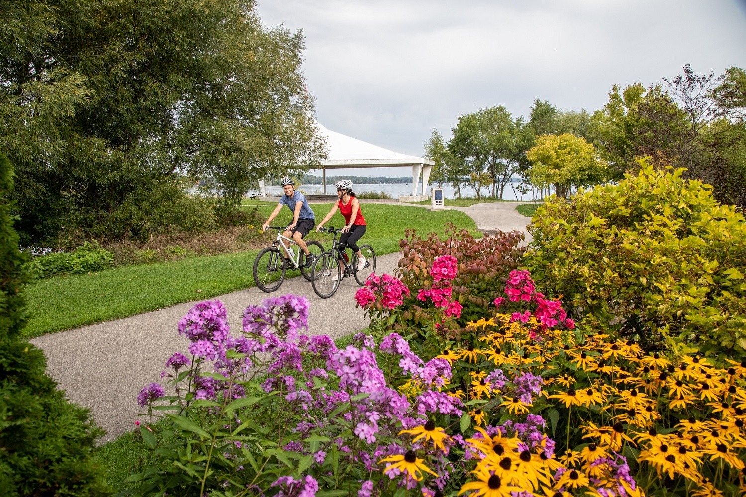
One result of the County’s focus on transportation is that infrastructure will be dramatically expanded in the coming decades. A new Cycling and Trails Master Plan was created in 2020 to complement the Official Plan and recommends developing 733 km of cycling and trail facilities over 20 years with 120 km in paved shoulders and 249 km in signed routes to be developed over the first 10 years. 

In partnership with students from the Urban and Rural Planning program at the University of Guelph, Grey County also developed Healthy Community and Residential Guidelines to encourage planning and development stakeholders to create connected, pedestrian-friendly, healthy communities that support physical activity. For example, it recommends a 400 metre walking radius to parks.   

“The years of education and collaboration are paying off,” notes Scott. “We have seen a change in the attitudes of elected representatives. When projects are proposed now, they are consistently asking important questions such as: ‘where are the parks? Where are the trails/sidewalks?’. There is a feeling across the County now that we are all working towards similar goals.”