Greening Parks and Playgrounds for Children in Windsor, Ontario

Written by Kim Perrotta

Background

Ever since it conducted a heat study that showed its playgrounds were often not cool enough to use in the summer, the City of Windsor in Ontario has been greening its parks and playgrounds to make them healthier and more inviting for children and their caretakers. 

It all started in 2012, when Karina Richters, Supervisor of Environmental Sustainability and Climate Change for the City of Windsor and the mother of a young child herself noticed that it was often too hot to enjoy Windsor’s playgrounds in the summer months.  

Her experience was affirmed by staff at the Windsor-Essex County Health Unit who believe that the high temperatures at playgrounds can be dangerous for children and discourage children from getting the physical activity needed to maintain good health.  Public health staff also expressed concerns about the UV exposure that children can experience at playgrounds because it may increase their risk of skin cancer later in life.  

Looking to address hot temperatures in Windsor’s playgrounds, Karina sought support from Health Canada staff, who provided technical advice and a small amount of funding so Windsor could hire a student for three summers to conduct a “thermal comfort study” in the city’s parks and downtown core. 

The study, conducted in collaboration with the Parks Department, was directed at playgrounds in six of the 202 parks in Windsor – two neighbourhood parks, two community parks, and two regional parks. It found that parks with more vegetation and shade coverage are much cooler, water features attract more park users, and certain materials, such as asphalt, can drive up surface temperatures on hot, sunny summer days. 

Policy changes and Interventions

The findings of the thermal comfort study motivated the city to take action. 

Since conducting the thermal comfort study in 2012, the City has:

  • Installed shade structures at 14 parks
  • Provided shaded seating at five parks
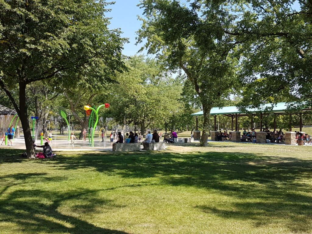
  • Installed splash pads at four parks
  • Installed four water bottle filling stations at three parks
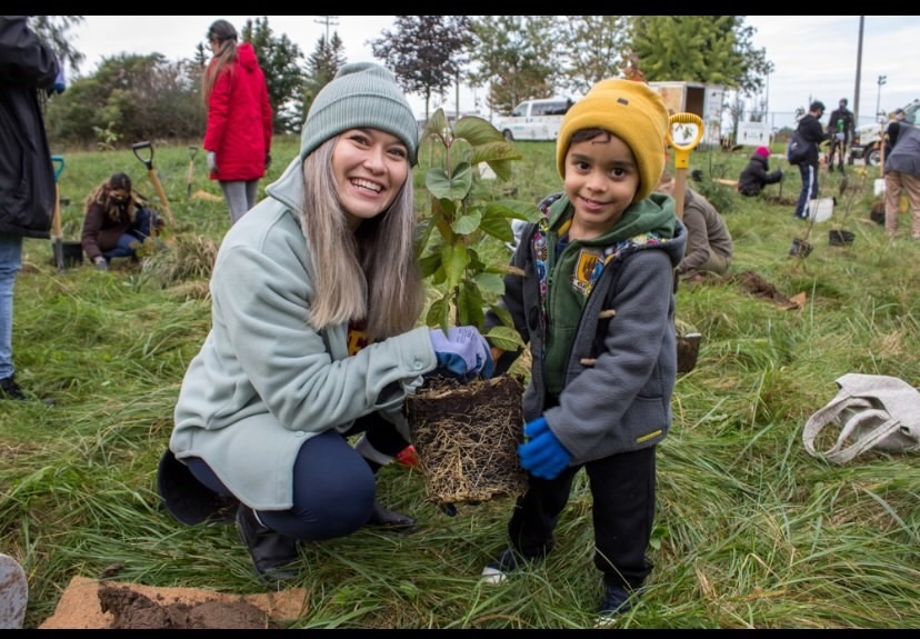
  • And planted trees at all 27 new playgrounds.

The Parks Department also established policies that require the City to locate and design new playgrounds with a consideration for shade provided by mature trees and existing vegetation in the park.  These policies have been integrated into the 20-year Parks and Outdoor Recreation Master Plan that the City will implement until 2035. This Plan specifically mandates shade targets for all parks:

“Determine shade targets through Forestry and Environmental Services as a follow-up to the Shade Audit for all parks in the Parks Greenway System as well as rights-of-ways in order to provide healthy shaded access throughout the city and help offset the impact of climate change.”

It also includes a recommendation for splash pads with the recognition that these amenities are needed to adapt to climate change and address “the intensity of heat that Windsor experiences in the summer months”. The new Master Plan also includes equity-based language to ensure that neighbourhoods with greater needs are well serviced by parks and playgrounds

There have been some unexpected spin-off benefits associated with Windsor’s work on playgrounds.  The Canadian Safety Association (CSA) has added an appendix to its Playground Equipment and Surfacing Guidelines that addresses heat and shade informed by the findings and experience in Windsor. These are guidelines that can be used by communities across the country.
Healing Streets in Winnipeg

Written by Kim Perrotta

Background

The Healing Trails project, which began in 2020, is an Indigenous-led initiative that was developed with support and resources from the Winnipeg Trails Association. It involves re-thinking transportation systems, building capacity among young people, reintegrating Indigenous language into public spaces, and creating tangible real-world projects. 

With the motto, “Healing the Land to Heal the People”, the project is focused on transforming roads to reflect the culture and values of Indigenous people. 

“We think that pathways should be accessible to people through all the stages of their lives,” noted Janell Henry, Project Manager of the Healing Trails Project, who is from Roseau River Anishinaabe First Nation. “Indigenous people dream of roads with street signs in Ojibwe or Cree; cities that give priority to snowshoeing in the winter; and travel ways that are lined with medicine plants and Indigenous art. We wanted to see if we could transform one street in the city to reflect our values in a way that might be replicated across the city.” 

Process

The street selected for this project– Rover Avenue – is a wide street that runs beside the Red River and connects to the Annabella underpass. It is the site of Winnipeg’s first painted bike lane. Rover lies along the only low traffic access point under a railroad that bisects the western half of the city. Despite being part of a national trail, Rover Avenue has long been a road that invites fast driving, while a trail on the river side of the road attracts people pushing strollers and riding bikes with young children.

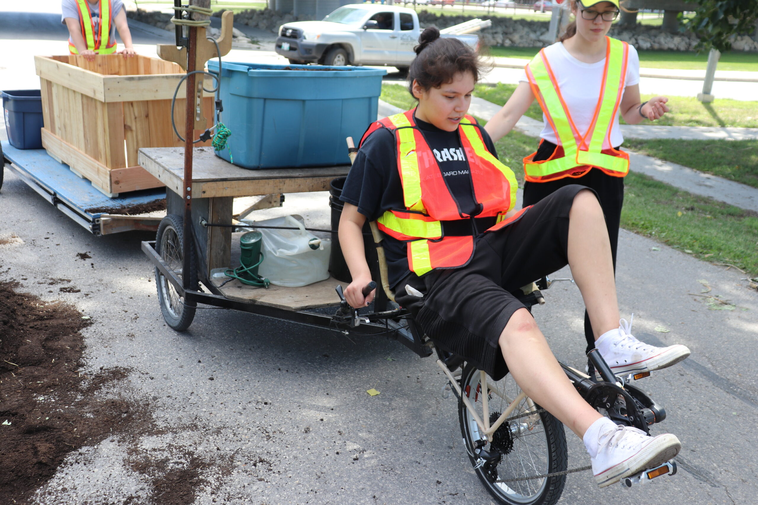
The project team went door to door to meet people in the neighbourhood and tell them about the project. They then began building ten cedar planters – which are the size of a car – with the intention of installing them along the length of Rover Avenue to create chicanes that would dramatically slow automobiles along the road. When they were unable to get permission from the city to do so, they positioned them along one side of the road – close enough to the curb to be acceptable to traffic engineers but far enough out to narrow the road. This immediately slowed motorized vehicles and made it somewhat safer for people to travel on foot and bicycles. 

The planters were filled with soil and medicines such as food plants that are considered medicine by Indigenous people and healing plants such as cedar, sage and sweetgrass. The result is a street filled with squash, tomatoes, saskatoon bushes and basil growing where asphalt once was. Way-finding signs have also been installed along the road in Cree and Ojibwe as well as English.  


Outcomes

The Healing Trails Project was able to infuse Rover Avenue – a street that can be used by hundreds of cyclists and pedestrians each day in good weather – with a taste of Indigenous languages, culture and landscape with about $15,000 in funding. It also laid the groundwork for retrofits done on two other streets in Winnipeg – McDermott and Bannatyne –  and will be replicated in future projects done by the Winnipeg Trails Association as funds are secured.  

“Through the Healing Trails project, we were also able to contribute to the development of two new logos for the Trans Canada Trail which includes Cree and Ojibwe for the first time. We also mocked up a map of desirable access points to identify new and exciting river-focused programming and Indigenous cultural-themed tours along the ‘Great Trail’ with a special focus on the canoe-culture of the Anishinaabe,” offered Anders Swanson, Executive Director at the Winnipeg Trails Association. “We would like to see this approach taken more often in Winnipeg. We would like to see Indigenous languages, culture and approaches to life embedded in the way that we do everything in the city.” 

“In the first year, with about $100,000 collected from a number of different funding sources, the Healing Trails project created eight full-time or part-time seasonal positions for Indigenous people in Winnipeg,” noted Janell.We were given the chance to lead, to develop new skills, and to take stewardship of the land, using our languages, and our ideas. We have also presented our work multiple times on local and international stages.”

The Healing Trails project also inspired several other projects designed to cultivate Indigenous languages and culture in the landscape. For example, the Speech Act Project – which is being done in partnership with the Urban Shaman Contemporary Aboriginal Art Gallery – aims to bring Indigenous languages into the public sphere with art and stories. 

Weaving Equity into the Region of Peel’s Tree Planting Priorities

Photo courtesy of Credit Valley Conservation.

Written by Kim Perrotta

Background

The Region of Peel has woven social equity and climate concerns into its tree planting strategy and developed a tool to help prioritize areas for tree planting. 

With a population of 1.4 million people, Peel Region is a rapidly growing area located on the west side of Toronto, that includes the Cities of Mississauga and Brampton, and the Town of Caledon.  

“With the development and growth that is coming to this region, various partners collaborated to create supportive tools and policies that would protect and enhance the tree canopy in our communities,” said Mark Pajot, Climate Change Advisor, Corporate Services, Region of Peel. “We wanted to ensure that these policies considered the many benefits that trees can provide and find synergies among the various priorities of different departments and agencies in the region.” 

Process

A multi-disciplinary project team was established that included staff from several departments within the Region and from the two conservation authorities –Toronto Region Conservation Authority (TRCA) and Credit Valley Conservation (CVC).  Over the course of two years, this team identified eight overall benefits – such as reducing the urban heat island effect – and categorized them under three sustainability themes – environmental, economic, and social.  

“Planning brought the conservation authorities, local municipalities, public health professionals, foresters and planners together to identify the priorities of each group and the criteria that should be used to decide where trees are needed most,” explained Mark. “We had multiple environmental, public health and social priorities to be addressed. For example, we wanted to cool urban heat islands to protect people from increasing temperatures, and we wanted to reduce health inequities by ensuring low-income neighbourhoods that lack tree canopy and greenspace, have greater coverage with trees.” 

After reviewing the scientific evidence and consulting with content experts, the project team identified data sources for the various benefits and the weighting that should be given to each one.  This interactive map became the Region’s Tree Planting Prioritization Tool. 

Outcomes

The tool identifies the areas in Peel that should be prioritized for tree planting by considering a broad range of management goals (e.g. increased habitat for wildlife) and community benefits (e.g. air quality improvement). Maintained by the Peel Data Centre, the tool can be used by the Region, local municipalities, and the conservation authorities to decide where trees will be planted and how to allocate funds.

“As an example of its application, this tool helped us develop a detailed map of Peel that identifies neighbourhoods that are particularly vulnerable to extreme heat. Vulnerability is a function of socioeconomic factors such as age and income, surface temperatures (i.e. grassy and shaded surfaces are cooler than paved surfaces), and the adaptive capacity of each neighbourhood (i.e. access to community pools or cooling centres gives people the ability to reduce their exposure to heat),” said Meaghan Eastwood, Senior Research Scientist, Ecosystem and Climate Science, with TRCA. By combining data sets for these different indicators, we can produce a Vulnerability Index Score for each neighbourhood. The neighbourhoods with the highest score can then be prioritized for tree planting because we know that mature trees can reduce local air temperatures.” 

“While we’re still in the early stages of a targeted tree planting strategy, we’re hopeful that we can increase the resiliency of neighbourhoods by growing the urban forest and decreasing the health risks associated with extreme heat events,” said Meaghan. 

Heather Hewitt, Planner with the Region of Peel expressed optimism in the application of the tool to practice. “In the future, we plan to leverage the tool, and the lessons learned from it, to ensure new developments prioritize access to trees, parks and greenspace.”

Toronto Introduces Equity Lens to Cycling Infrastructure

Written by Kim Perrotta

The Challenge

Historical practices have resulted in the inequitable delivery of services to some areas of Toronto. The unequal burden of COVID-19 among residents revealed the economic, racial, health and social disparities that exist in some neighbourhoods. 

But even before the pandemic, the City recognized the need to transform many of its systems, including how transportation projects are planned and implemented, to address those inequities. This applies to cycling infrastructure as well as other modes of transportation.  

“Historically, there has been much more investment in on-street cycling infrastructure in the downtown core of Toronto, than in the suburbs. This has meant that a number of lower income neighbourhoods in the City’s suburbs have not been well served by cycling investments,” offered Katie Wittmann, Project Lead, Capital Projects and Program, Transportation Services. “In 2019, we developed a Cycling Network Plan that applied an equity lens for the first time to give greater priority to underserved neighbourhoods in the city. A similar equity-based approach is being applied to other modes of transportation as well.”  

The Process

The equity lens applied to the 2019 Cycling Network Plan was grounded in the Neighbourhood Improvement Areas (NIAs) that were identified by the City in 2014. Toronto’s 140 neighbourhoods were scored using 15 indicators of neighbourhood inequity with statistics related to issues such as income levels, education, the walkability of neighbourhoods, voter turnout, and health risks such as diabetes. The results were used to score neighbourhoods on a Neighbourhood Equity Index. Neighbourhoods that passed a certain threshold were identified as NIAs that would receive additional staff support and funding to address inequities. The 2019 Cycling Network Plan added NIAs to the prioritization process for future cycling investments.  

The 2021 Cycling Network Plan Update, which was approved by City Council in December 2021, applies an expanded equity-based approach.  This time, staff combined a neighbourhood analysis of cycling infrastructure with a neighbourhood analysis of equity to create a Neighbourhood Cycling and Equity Map that combines both ratings and their overlap to prioritize investments. The 2021 Cycling Network Plan Update also shares analyses of other equity-related variables, such as crowded transit routes and areas that need more parkland, which are also considered in the expanded prioritization process

“We engaged with some advocacy, academic, and community groups on the revised approach but were limited in our ability to consult because of the pandemic,” noted Katie. “There was overall support for the updated analyses and approach, but we would like to do more consultation on the broader transportation programming process in the coming years, in addition to the project-specific consultations that already take place for each cycling route.” 

The Outcome

The installation of cycling infrastructure over the last three years has been unprecedented in Toronto’s history. From 2019 to 2021, 65 km of new bikeways were installed and 47 km of existing cycling routes were upgraded or enhanced. This work has accelerated progress towards the City’s goal of making cycling infrastructure accessible (i.e. within 250 to 500 metres) to all of the City’s population and jobs. The percentage of people and jobs that have access to cycling infrastructure has increased from 62.8% to 67.1% over the last three years. This means that about 180,000 more people are living or working within close proximity of a cycling route today than in 2018.   

“We have also seen some concrete improvements in underserved neighbourhoods over the last few years. For example, many cycling routes have been installed in Thorncliffe Park & Flemingdon Park (#55 and #44 on the map) and near York University and Downsview (#27 and #26 on the map), and there are more routes in these and other NIAs planned for the near-term” said Katie. 

The 2021 Cycling Network Plan identifies the need to increase the cycling budget to enhance public consultations, hire more staff to support design, consultation and delivery of cycling infrastructure, and for an increase in the capital budget from $16 million per year to $20 million per year.

“Since 2016, we have not increased the cycling budget to meet our equity goals; we have simply re-allocated existing funds for those goals,” explained Katie. “However, the pandemic brought a huge demand for cycling infrastructure from residents and Councillors alike which resulted in increased spending in 2020 to meet that demand, and we don’t see that demand changing in the future.”

All photos courtesy of Kanchan Maharaj.

Creating Healthy, Age-Friendly Communities in Rural Canada-Grey County

Written by Kim Perrotta

Tucked under the scenic southern shore of Georgian Bay in Ontario, Grey County is home to nearly 100,000 people who live in dispersed housing across 4,500 square kilometres of rural areas and small urban centres. Owen Sound, with a population of 22,000 people, is the County’s largest urban centre. 

“About 10 years ago, the Health Unit began cultivating relationships with our municipal partners, in particular the Planning Departments in Grey and Bruce Counties, because our counties have high rates of obesity and chronic disease. For example, the rate of cardiovascular disease deaths is 27% higher in Grey and Bruce Counties than the provincial average,” said Jason Weppler, Program Manager, Chronic Disease and Injury Prevention, Grey Bruce Health Unit. “To some extent, these health statistics reflect the fact that both rural counties have older populations.” 

About 24% of the people in Grey and Bruce Counties are over 65 compared with 17% of Ontarians. And that difference is not expected to change over the next 20 years. But other factors also contribute to higher rates of chronic disease. 

“With no transit, dispersed housing, and small urban centres that were not developed with “walkability” in mind, people in these counties have had fewer opportunities to maintain the levels of physical activity needed for good health. These are issues that can only be addressed by looking at how we design and develop our communities,” Weppler said.

In light of these trends, the County and Health Unit have been collaborating to create healthy, age-friendly communities. In the early years, the planners and public health professionals worked to understand one another’s goals and processes. More recently, they have cultivated relationships with engineers and developers in the County, particularly around issues related to transportation systems.  

“As Planners, we don’t necessarily have training in the social and environmental indicators of health so we didn’t understand how community design might influence physical and mental health in our communities. It has been helpful to work with the health unit to understand their goals and to get their help shaping our policies,” offers Scott Taylor, Manager of Planning Services, Grey County. “It has been particularly useful that these conversations are also happening at all levels of staff in our organizations and at the Board of Health where the Medical Officer of Health has been working to educate the mayors and deputy mayors about the links between community design and public health.” 

Grey County’s new Official Plan, approved by the Province in 2019, reflects the inter-sectoral collaboration that has occurred in Grey County. It includes a number of over-arching policies, and many very specific policies, that aim to encourage the development of age-friendly, healthy communities. It identifies the need to promote active transportation infrastructure including pedestrian furniture, safe and accessible public open spaces, access to green space, access to healthy affordable local foods, and development for all ages and abilities, and residential intensification, while limiting exposure to environmental hazards. 

To achieve these goals, the Official Plan commits the County to considering a wide variety of transportation modes when designing its roads. It indicates, for example, that the County will consider paved shoulders for all County roads to support cyclists and other alternate modes of travel. It also considers the connection of existing and future trails, sidewalks, and paved shoulders throughout the County, acknowledging the health benefits of a connected active transportation network.

Wanting to see these recommendations implemented in each new build, the two Counties and the Health Unit provide a Healthy Development Checklist to developers at the front end of the development process so they can integrate healthy community designs into their projects. It recommends supporting mixed land use by integrating a variety of residential development within 800 metres of retail, recreational centres, parks and public spaces; preserving urban forests and dedicating no less than 5% of the total proposed land area to outdoor public spaces; and designing neighbourhood blocks that are less than 250 meters in length.

One result of the County’s focus on transportation is that infrastructure will be dramatically expanded in the coming decades. A new Cycling and Trails Master Plan was created in 2020 to complement the Official Plan and recommends developing 733 km of cycling and trail facilities over 20 years with 120 km in paved shoulders and 249 km in signed routes to be developed over the first 10 years. 

In partnership with students from the Urban and Rural Planning program at the University of Guelph, Grey County also developed Healthy Community and Residential Guidelines to encourage planning and development stakeholders to create connected, pedestrian-friendly, healthy communities that support physical activity. For example, it recommends a 400 metre walking radius to parks.   

“The years of education and collaboration are paying off,” notes Scott. “We have seen a change in the attitudes of elected representatives. When projects are proposed now, they are consistently asking important questions such as: ‘where are the parks? Where are the trails/sidewalks?’. There is a feeling across the County now that we are all working towards similar goals.”