Weaving Public Health into Projects in Coaldale, Alberta

Written by Kim Perrotta

Background

In 2018, the Town of Coaldale, Alberta, began thinking about how it might bring health considerations into new projects to create a healthier community. 

The town, which has a population of 9,000 people, has made considerable advances in the built environment including a new multi-use recreation centre designed to accommodate a variety of community programming opportunities, while expanding its multi-user trails by approximately four kilometres over the past four years. 

“We have a young population. The average age is 36 and there are a lot of children in town. So recreational facilities and cycling paths are in high demand,” said Spencer Croil, Director of Planning and Development and Deputy Chief Administrative Officer of the town.  “We used the revitalization of the downtown core as an opportunity to encourage walking and cycling. Main Street extends only four blocks but it is a gathering point for everyone in the community. So, we worked to ensure that those blocks were built to a human scale that would make it a comfortable space to walk, gather and recreate,” said Spencer.

Process 

As part of the Town’s commitment to support the ongoing health needs of the community, in early 2021, it partnered with two divisions of Alberta Health Services to initiate a pilot program called Healthy Communities by Design.  

“Using Alberta Health Services’ Healthy Places Action Tool, we engaged the community through a Healthy Communities Working Group to assess the town in six health-related areas, including opportunities for physical activity, healthy eating, reduced alcohol and tobacco use, UV (ultraviolet) protection, and cancer screening,” said Melanie Messier, a Planner with the Town

“We received valuable feedback from the working group that was comprised of town councillors, school representatives, the town’s parks and recreation departments, the public library, a local business owner, and representatives from the Family and Community Support Services (FCSS) program,” said Melanie.

Outcomes 

The working group and report prepared by Alberta Health Services concluded that Coaldale was well-served with recreational facilities but could do more to support healthy eating and cancer screening. One in ten households in Alberta experience challenges in accessing healthy food options.

“A natural next step for us was to weave these findings into a variety of major projects and programs that are in development in town,” said Melanie. “We are also using them to begin drafting a Healthy Communities Strategic Plan.”  

The Strategic Plan is also being developed with a consideration of community health. Inspired by the Conference Board of Canada’s Community Wellbeing Framework, the Town will use it as the basis for conversations on future developments intended to address the priority areas identified by the residents. 

Having identified areas of improvement, residents are getting involved in proposing solutions to address the priority areas. For example, the Town is currently working with local Kate Andrews High School students who are developing proposals for a Community Improvement Project

“Students have been given an $8,000 budget based on grant funding to develop their proposals in either one or more of the health-related topic areas” said Melanie “One of the proposals that we plan to act on is the establishment of a Farmer’s Market on the newly revitalized Main Street.”  

Beyond providing more opportunities for healthy eating, farmer’s markets also provide health and social co-benefits. They promote social connection and community cohesion, while also providing opportunities for community members to get outside and walk around. 

Greening Parks and Playgrounds for Children in Windsor, Ontario

Written by Kim Perrotta

Background

Ever since it conducted a heat study that showed its playgrounds were often not cool enough to use in the summer, the City of Windsor in Ontario has been greening its parks and playgrounds to make them healthier and more inviting for children and their caretakers. 

It all started in 2012, when Karina Richters, Supervisor of Environmental Sustainability and Climate Change for the City of Windsor and the mother of a young child herself noticed that it was often too hot to enjoy Windsor’s playgrounds in the summer months.  

Her experience was affirmed by staff at the Windsor-Essex County Health Unit who believe that the high temperatures at playgrounds can be dangerous for children and discourage children from getting the physical activity needed to maintain good health.  Public health staff also expressed concerns about the UV exposure that children can experience at playgrounds because it may increase their risk of skin cancer later in life.  

Looking to address hot temperatures in Windsor’s playgrounds, Karina sought support from Health Canada staff, who provided technical advice and a small amount of funding so Windsor could hire a student for three summers to conduct a “thermal comfort study” in the city’s parks and downtown core. 

The study, conducted in collaboration with the Parks Department, was directed at playgrounds in six of the 202 parks in Windsor – two neighbourhood parks, two community parks, and two regional parks. It found that parks with more vegetation and shade coverage are much cooler, water features attract more park users, and certain materials, such as asphalt, can drive up surface temperatures on hot, sunny summer days. 

Policy changes and Interventions

The findings of the thermal comfort study motivated the city to take action. 

Since conducting the thermal comfort study in 2012, the City has:

  • Installed shade structures at 14 parks
  • Provided shaded seating at five parks
  • Installed splash pads at four parks
  • Installed four water bottle filling stations at three parks
  • And planted trees at all 27 new playgrounds.

The Parks Department also established policies that require the City to locate and design new playgrounds with a consideration for shade provided by mature trees and existing vegetation in the park.  These policies have been integrated into the 20-year Parks and Outdoor Recreation Master Plan that the City will implement until 2035. This Plan specifically mandates shade targets for all parks:

“Determine shade targets through Forestry and Environmental Services as a follow-up to the Shade Audit for all parks in the Parks Greenway System as well as rights-of-ways in order to provide healthy shaded access throughout the city and help offset the impact of climate change.”

It also includes a recommendation for splash pads with the recognition that these amenities are needed to adapt to climate change and address “the intensity of heat that Windsor experiences in the summer months”. The new Master Plan also includes equity-based language to ensure that neighbourhoods with greater needs are well serviced by parks and playgrounds

There have been some unexpected spin-off benefits associated with Windsor’s work on playgrounds.  The Canadian Safety Association (CSA) has added an appendix to its Playground Equipment and Surfacing Guidelines that addresses heat and shade informed by the findings and experience in Windsor. These are guidelines that can be used by communities across the country.

Healing Streets in Winnipeg

Written by Kim Perrotta

Background

The Healing Trails project, which began in 2020, is an Indigenous-led initiative that was developed with support and resources from the Winnipeg Trails Association. It involves re-thinking transportation systems, building capacity among young people, reintegrating Indigenous language into public spaces, and creating tangible real-world projects. 

With the motto, “Healing the Land to Heal the People”, the project is focused on transforming roads to reflect the culture and values of Indigenous people. 

“We think that pathways should be accessible to people through all the stages of their lives,” noted Janell Henry, Project Manager of the Healing Trails Project, who is from Roseau River Anishinaabe First Nation. “Indigenous people dream of roads with street signs in Ojibwe or Cree; cities that give priority to snowshoeing in the winter; and travel ways that are lined with medicine plants and Indigenous art. We wanted to see if we could transform one street in the city to reflect our values in a way that might be replicated across the city.” 

Process

The street selected for this project– Rover Avenue – is a wide street that runs beside the Red River and connects to the Annabella underpass. It is the site of Winnipeg’s first painted bike lane. Rover lies along the only low traffic access point under a railroad that bisects the western half of the city. Despite being part of a national trail, Rover Avenue has long been a road that invites fast driving, while a trail on the river side of the road attracts people pushing strollers and riding bikes with young children.

The project team went door to door to meet people in the neighbourhood and tell them about the project. They then began building ten cedar planters – which are the size of a car – with the intention of installing them along the length of Rover Avenue to create chicanes that would dramatically slow automobiles along the road. When they were unable to get permission from the city to do so, they positioned them along one side of the road – close enough to the curb to be acceptable to traffic engineers but far enough out to narrow the road. This immediately slowed motorized vehicles and made it somewhat safer for people to travel on foot and bicycles. 

The planters were filled with soil and medicines such as food plants that are considered medicine by Indigenous people and healing plants such as cedar, sage and sweetgrass. The result is a street filled with squash, tomatoes, saskatoon bushes and basil growing where asphalt once was. Way-finding signs have also been installed along the road in Cree and Ojibwe as well as English.  


Outcomes

The Healing Trails Project was able to infuse Rover Avenue – a street that can be used by hundreds of cyclists and pedestrians each day in good weather – with a taste of Indigenous languages, culture and landscape with about $15,000 in funding. It also laid the groundwork for retrofits done on two other streets in Winnipeg – McDermott and Bannatyne –  and will be replicated in future projects done by the Winnipeg Trails Association as funds are secured.  

“Through the Healing Trails project, we were also able to contribute to the development of two new logos for the Trans Canada Trail which includes Cree and Ojibwe for the first time. We also mocked up a map of desirable access points to identify new and exciting river-focused programming and Indigenous cultural-themed tours along the ‘Great Trail’ with a special focus on the canoe-culture of the Anishinaabe,” offered Anders Swanson, Executive Director at the Winnipeg Trails Association. “We would like to see this approach taken more often in Winnipeg. We would like to see Indigenous languages, culture and approaches to life embedded in the way that we do everything in the city.” 

“In the first year, with about $100,000 collected from a number of different funding sources, the Healing Trails project created eight full-time or part-time seasonal positions for Indigenous people in Winnipeg,” noted Janell.We were given the chance to lead, to develop new skills, and to take stewardship of the land, using our languages, and our ideas. We have also presented our work multiple times on local and international stages.”

The Healing Trails project also inspired several other projects designed to cultivate Indigenous languages and culture in the landscape. For example, the Speech Act Project – which is being done in partnership with the Urban Shaman Contemporary Aboriginal Art Gallery – aims to bring Indigenous languages into the public sphere with art and stories. 

The Long Road to Complete Streets in Hamilton

Written by Kim Perrotta

Back in 2011 and 2012, the City of Hamilton started community discussions about “complete streets” when it organized a transportation summit on the topic with the non-profit organization, Share the Road.  A commitment to develop “complete streets” was adopted several years later in the City’s 2018 Transportation Master Plan.

“Complete streets is an approach to road design that balances the needs of people of all ages and abilities and all modes of transportation in an equitable manner,” offered Trevor Jenkins, Project Manager in Sustainable Mobility Planning at the City of Hamilton. “It represents a shift from historical approaches to street design that were focused primarily on motorized vehicles.” 

The Process

The 2018 Transportation Master Plan committed the City to develop a Complete, Livable, Better (CLB) Streets Design Manual that could be used to operationalize the commitment to complete streets.

“By 2015 when the city began work on the Transportation Master Plan, there was no longer any question about whether we should develop complete streets. By then, people recognized that complete streets offer so many public health, environmental and social benefits,” offered Trevor. “Complete streets are safer for all travellers. They foster health by encouraging physical activity. They reduce air pollution, climate emissions and traffic congestion. And they are more equitable and increase community resiliency by providing more options.” 

In 2019, City staff turned their attention to operationalizing complete streets – trying to figure out how to make it happen. They spent two years identifying and classifying the different types of streets in Hamilton and examining the designs being recommended for each type of street by other organizations and communities that are aiming to create complete streets. 

“There is a lot to consider when re-designing streets. There are water and wastewater pipes, electrical lines, and other utilities under and around streets,” explained Trevor. “We have to work around this infrastructure while considering how to accommodate the different modes of transportation, trees, snow storage, pedestrian furniture, bike racks and transit shelters. There is limited space to work with and the needs for each will vary depending on the local context.”

The Outcome

The work of city staff since 2019 is reflected in a report that was approved by City Council in January 2021 entitled, Complete, Livable, Better Streets – Policy and Framework. This report identifies the different types of streets in Hamilton – urban avenues, transitioning avenues, main streets, connectors, neighbourhood streets, industrial roads, rural roads, and rural villages – and proposes designs or “streetscape elements” for each.  

The list of streetscape elements includes the pedestrian realm and placemaking, cycling facilities and transit facilities, motor vehicle lanes, green infrastructure, and utilities and municipal services. The report also includes policies and examples to help staff decide how to re-design a street that is being renewed or rebuilt. 

The public is now being consulted on these designs with a detailed survey that seeks feedback on each of the designs proposed for each of the seven types of streets. Staff plan to bring the final recommendations to City Council in the spring of 2022.  

“We have already begun renewing streets across Hamilton. For example, bike lanes separated by posts have been installed along Cannon Street in the downtown core. On Hatt Street in the west end of Hamilton (in Dundas), we have installed bike lanes protected by concrete barriers and parked cars,” said Trevor. “And, when we re-surfaced the Claremont Trail, that joins the lower side of the City to the neighbourhoods on the top of the escarpment, we installed a 2.1 km multi-use path that is separated from the road by a 1.4 m concrete and aluminum barrier so pedestrians and cyclists can safely travel directly up the escarpment.” 

The community has responded positively to these changes and there has been good pick-up by cyclists and pedestrians. The number of cyclists using Cannon Street has increased from 30 per day in 2013, before the separated bike lanes were installed, to 390 per day in 2014 one year after their installation, to 660 per day in 2021.  With the re-surfaced Claremont Trail, active travellers have increased from one dozen cyclists and pedestrians per day before the installation of the multi-use path called the Keddy Trail, to an average of 620 cyclists and pedestrians per day since its installation. 

Once the street designs and policies are approved by City Council, they will be applied to all streets in the City as each one comes up for renewal.  

“Streets last 25 to 50 years so this is a long-term process that will gradually transform our city,” notes Trevor. “Complete streets generally do not cost more than regular streets. It is about doing things differently when a street is renewed or rebuilt.”

Weaving Equity into the Region of Peel’s Tree Planting Priorities

Photo courtesy of Credit Valley Conservation.

Written by Kim Perrotta

Background

The Region of Peel has woven social equity and climate concerns into its tree planting strategy and developed a tool to help prioritize areas for tree planting. 

With a population of 1.4 million people, Peel Region is a rapidly growing area located on the west side of Toronto, that includes the Cities of Mississauga and Brampton, and the Town of Caledon.  

“With the development and growth that is coming to this region, various partners collaborated to create supportive tools and policies that would protect and enhance the tree canopy in our communities,” said Mark Pajot, Climate Change Advisor, Corporate Services, Region of Peel. “We wanted to ensure that these policies considered the many benefits that trees can provide and find synergies among the various priorities of different departments and agencies in the region.” 

Process

A multi-disciplinary project team was established that included staff from several departments within the Region and from the two conservation authorities –Toronto Region Conservation Authority (TRCA) and Credit Valley Conservation (CVC).  Over the course of two years, this team identified eight overall benefits – such as reducing the urban heat island effect – and categorized them under three sustainability themes – environmental, economic, and social.  

“Planning brought the conservation authorities, local municipalities, public health professionals, foresters and planners together to identify the priorities of each group and the criteria that should be used to decide where trees are needed most,” explained Mark. “We had multiple environmental, public health and social priorities to be addressed. For example, we wanted to cool urban heat islands to protect people from increasing temperatures, and we wanted to reduce health inequities by ensuring low-income neighbourhoods that lack tree canopy and greenspace, have greater coverage with trees.” 

After reviewing the scientific evidence and consulting with content experts, the project team identified data sources for the various benefits and the weighting that should be given to each one.  This interactive map became the Region’s Tree Planting Prioritization Tool. 

Outcomes

The tool identifies the areas in Peel that should be prioritized for tree planting by considering a broad range of management goals (e.g. increased habitat for wildlife) and community benefits (e.g. air quality improvement). Maintained by the Peel Data Centre, the tool can be used by the Region, local municipalities, and the conservation authorities to decide where trees will be planted and how to allocate funds.

“As an example of its application, this tool helped us develop a detailed map of Peel that identifies neighbourhoods that are particularly vulnerable to extreme heat. Vulnerability is a function of socioeconomic factors such as age and income, surface temperatures (i.e. grassy and shaded surfaces are cooler than paved surfaces), and the adaptive capacity of each neighbourhood (i.e. access to community pools or cooling centres gives people the ability to reduce their exposure to heat),” said Meaghan Eastwood, Senior Research Scientist, Ecosystem and Climate Science, with TRCA. By combining data sets for these different indicators, we can produce a Vulnerability Index Score for each neighbourhood. The neighbourhoods with the highest score can then be prioritized for tree planting because we know that mature trees can reduce local air temperatures.” 

“While we’re still in the early stages of a targeted tree planting strategy, we’re hopeful that we can increase the resiliency of neighbourhoods by growing the urban forest and decreasing the health risks associated with extreme heat events,” said Meaghan. 

Heather Hewitt, Planner with the Region of Peel expressed optimism in the application of the tool to practice. “In the future, we plan to leverage the tool, and the lessons learned from it, to ensure new developments prioritize access to trees, parks and greenspace.”

Fostering Physical Activity in Glace Bay, Nova Scotia

Written by Kim Perrotta

In 2019, the students in Glace Bay, Nova Scotia, organized for two years to have a new pedestrian pathway built in their community that will connect their high school to local businesses in town and encourage others in the town of 19,000 to increase their levels of physical activity.

“The former path, which students jokingly called ‘the Burr,’ was used unofficially by about 600 of the 800 students in our school,” explained Daniel MacGillivary, high school student and the Co-Executive of the Glace Bay High Change Makers Burr Group. “It was a very steep path that crossed a treacherous waterway. Students were not supposed to use it, but many did because it made it possible to reach local businesses during their lunch hour.”

Process

The project, called “Building Burr-idges; A Safe and Walkable Youth-led Pedestrian Pathway”, received strategic advice and support from staff at the Ecology Action Centre and Nova Scotia Public Health Services. The students also rallied support from community partners, local businesses, the school’s advisory committee and operations staff, Members of Parliament, and Members of the Legislative Assembly, to secure the trail easements, agreements, and funding needed to complete the project.

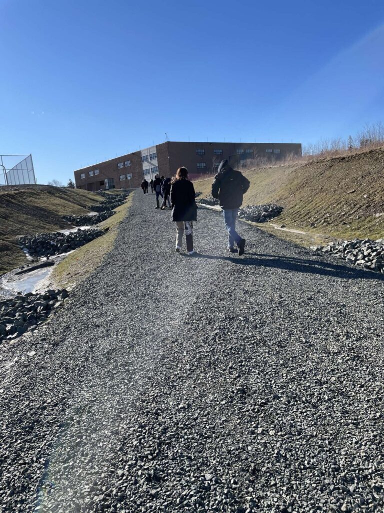
“The new pedestrian pathway and bridge – which will be accessible to everyone – is only 150 metres long, but it can fill a number of the community’s needs,” noted Stephanie Johnstone-Laurette from the Ecology Action Centre. “It will provide the students with a safe and convenient route to local businesses. It creates a potential walking loop that can be used by people in town to increase their levels of physical activity; something that is important in a rural community where recreational facilities are scarce. And it could also be used to connect with other recreational initiatives such as the Coal Town Trail, a new multi-use recreational trail network that follows an old railway line that has some historical significance for the town.”

The group worked to include positive amenities such as signage focused on mental health advocacy, two permanent benches, bike racks, and a picnic table for the public to use when the path opens in 2022.

“A key focus of this project was to re-create a public space” noted Daniel. “We wanted to create a public space that the community can take pride in; to provide a positive legacy for future students in Glace Bay.”     

Outcome

Funding for this project has been secured from several departments within the provincial and federal governments.

“The students did a great job organizing around this issue. They ultimately succeeded in gaining nearly $200,000 in infrastructure for their town,” Stephanie said. “And they have actually won three community awards for their dedicated work on this project.”

Holding the Line in Hamilton

Written by Kim Perrotta

Background

Late in 2021, the City of Hamilton voted to create a hard urban boundary for the city and became a leader in sustainable urban planning in Ontario. Much of the credit for that decision goes to community groups that engaged residents around the issue.

“Under the former provincial government, we had several planning strategies and policies in place in Ontario that were designed to curb urban sprawl and protect farmland and greenspace in the Greater Toronto & Hamilton Area (GTHA),” explained Lynda Lukasik, Executive Director of the non-profit organization, Environment Hamilton. “Those guidelines encouraged, sometimes even mandated, the development of complete communities that are walkable, bikeable and transit-supportive. But that has changed over the last few years. Our current provincial government has loosened many of the policies that were designed to control urban sprawl. For example, in Hamilton, the province has reduced minimum requirements for intensification, undoing policies designed to phase in more stringent targets over time.”

The Challenge

Working under the “loosened” provincial policies, the City of Hamilton tabled a proposal for development in the city out to 2051. This new proposal assessed the amount of land the city would need to accommodate the population growth it expected to see over the next 30 years. Assuming development patterns from the last 20 years would continue, the city projected that it would need to develop more than 3,000 acres of prime farmland surrounding the areas currently developed in the city.

“We challenged these projections because they are based on outdated development patterns and population preferences. The assessment does not reflect the changing attitudes of the population; that older people in our community are now looking to downsize within their community, while young adults are looking for a more urban lifestyle that supports active modes of transportation such as cycling,” offered Lynda. “Nor does this projection reflect the actions that are needed in the face of the climate crisis; the need to preserve prime farmland; the need for transit-supportive development that reduces climate emissions from the transportation sector.”

The Process

Environment Hamilton organized several webinars to engage Hamilton residents on the issue of the city’s urban boundary. Calling their webinars “Will Sprawl take it All?” and “Don’t Let Sprawl take it All”, they were surprised by the number of people who showed up and their passionate response to the issue.

“A huge number of people participated in our webinars and a new grassroots organization popped up calling itself, StopSprawl HamOnt,” noted Lynda. “People seemed most concerned about the loss of farmland and what that means for food security in the face of the climate crisis. This goes for the farming community as well. Local farmers and their organizations have also expressed strong support for a hard urban boundary.” 

The community groups began engaging the public in one-on-one meetings, on social media, and in webinars. StopSprawl HamOnt set up an on-line tool to allow residents to communicate directly with their City Councillors. They provided residents with “Stop Sprawl” lawn signs and placed ads on the radio. They encouraged residents to let their councillors know about their concerns. Environment Hamilton organized webinars for the public on the delegation process. 

“We explained the delegation process to residents,” said Lynda. “We helped them to understand how they could make a submission in writing or in person to the council meeting and provided tips about how to prepare an effective submission or presentation.” 

The Outcome

In March 2021, City Council responded to the calls from residents by instructing staff to send out a household survey on the issue. The survey was disseminated in hard form by the City. StopSprawl HamOnt made the survey available to residents with an on-line survey tool as well. In the end, the survey was completed by about 18,000 residents – more than 2% of Hamilton’s population. Ninety per cent of respondents supported the option of a “firm urban boundary” and strong support was expressed by residents from all wards across the city.    

When the question of the urban boundary came up at City Council in November 2021, about 120 people provided written submissions to Council and another 60 presented directly at the council meeting.  At that meeting, Hamilton City Council voted to hold a hard urban boundary in Hamilton out to 2051.

“City staff have now prepared a draft proposal on how to meet growth within the existing boundaries.  We will be looking at those proposals carefully. There will be a desire to increase densities around major transit stops and along corridors, such as the new Light Rail Transit (LRT) route, to make good use of efficient transit service. But we will also want to look for innovative ways to ‘create the missing middle’ – to produce neighbourhoods with moderate levels of density that are more walkable, bikeable and supportive of transit,” explained Lynda. “Our goal is to create a healthier, climate resilient, and equitable community. The hard urban boundary will help us to achieve that.”

Public Health and Planning Collaborate to Create 15-Minute City in Ottawa

Written by Kim Perrotta

Ottawa has become one of the first communities in Canada, perhaps in North America, to enshrine the 15-minute neighbourhood in its Official Plan.

“In Ottawa Public Health (OPH), our goal was to have the City’s new Official Plan built on a framework that creates communities that are healthy, inclusive, sustainable and resilient,” offers Inge Roosendaal, Healthy Communities Planner with Ottawa Public Health. “We were using our ‘Five C’s – compact, connected, convivial, complete and cool’ to describe our vision of neighbourhoods that would support these goals, but found we needed a more cohesive concept to communicate to the public and planners. So, we pitched the idea of the ‘15-minute neighbourhood’ and it resonated` with our communities.”  

Process

The concept of the 15-minute neighbourhood was captured in a high-level policy directions report called the “5 Big Moves” that was approved by Ottawa City Council in September 2019 and it became a framework around which the Official Plan was built.

To meet its goals, Ottawa Public Health  co-located two of its staff to the Planning Department for the three years that it took to develop the new Official Plan.

“It was seminal to the achievement of public health’s goals that public health staff were assigned to work with the Planning Department for the duration of the process. In the past, we were participants who were consulted.  This time, we collaborated as fully engaged partners at every stage of the Official Plan process,” explained Inge. “This gave us the time to engage in many conversations with our colleagues in other departments. It allowed us to pull together the health evidence needed to support the policies we were promoting. We prepared one of the background papers that informed the development of the Official Plan – called “Healthy Ottawa by Design.”  And we subsequently informed the discussions for the many sections the Official Plan.”

It was actually helpful that we were engaging in this process during the COVID-19 pandemic because Ottawa residents – who were in lockdown for some of the time – were really feeling the impact that their neighbourhoods have on their lives,” noted Birgit Isernhagen, Program Planning and Evaluation Officer in Ottawa Public Health. “Those who lived in well-designed neighbourhoods could walk and cycle, access essential services, and enjoy parks and green space, while those who lived in poorly designed neighbourhoods were really feeling the effects of isolation on their physical and mental health. We started referring to the ‘15-minute neighbourhood’ as a pandemic-resilient neighbourhood and that resonated with the public.”        

Outcomes

Approved by City Council in November 2021, the new Official Plan will guide development in Ottawa for the next 25 years – until 2046. It identifies five broad policy directions as “the foundation to becoming the most livable mid-sized city in North America over the next century.”  Those policies articulate the need to:

  • Accommodate more growth by intensification of existing neighbourhoods rather than by greenfield development;
  • Ensure that the majority of trips in 2046 will be made by sustainable modes of transportation such as walking, cycling, transit or carpooling;
  • Use sophisticated urban and community design principles to create stronger, more inclusive and vibrant neighbourhoods and villages that also reflect and integrate Ottawa’s economic, racial and gender diversity;
  • Embed environmental, climate and health resiliency and energy into the framework of planning policies to support walkable 15-minute neighbourhoods with a diverse mix of land uses, and mature trees, greenspaces and pathways, that help the City achieve its net zero climate commitment for 2050, its 40% urban forest canopy cover target, and increase the City’s resiliency to the effects of climate change.
  • Embed economic development into the framework of the planning policies.

The Official Plan identifies six cross-cutting strategic policy directions that are advanced through implementation policies in multiple sections of the Plan. The Healthy and Inclusive Communities, the Climate Change and Energy, and Gender and Racial Equity policies are included in this list.

“While the broad Healthy and Inclusive Communities policies address sustainability, health equity, the need for age-friendly and inclusive communities, the cornerstone framework that pulls these elements together is the 15-minute neighbourhood” explains Inge. “We describe the 15-minute neighbourhood through policy as one that is well-connected to a diverse mix of land uses, includes a range of housing types and affordabilities, provides easy access to shops, services, schools and childcare, employment, greenspaces, parks and pathways, and is well serviced by active transportation and transit.”

“Public health staff were not responsible for developing the broad Climate Change and Energy policies, but we worked closely with our Planning colleagues to ensure that the Official Plan policies addressed the actions needed to increase community resiliency and protect the public from the impacts of the changing climate,” offered Birgit. “For example, it includes commitments to reduce the urban heat island effect, improve access to shade, preserve nature, support community gardens and food production, and enable active transportation, transit use and outdoor recreation in all weather conditions. It also notes the need to employ an equity and inclusion lens when implementing climate policies.”

Specific recommendations for these cross-cutting policies have been integrated throughout the Official Plan to ensure that the strategic goals are actually implemented. They will also be supported by other policies and plans that have been, or will be, developed by the City. For example, in September 2021, the City released a 15-Minute Neighbourhoods Baseline Report that analyses existing neighbourhoods across Ottawa against the criteria for the 15-minute neighbourhood and identifies the next steps for implementing the policy goals enshrined in the Official Plan.

All images courtesy of Ottawa Public Health.

Toronto Introduces Equity Lens to Cycling Infrastructure

Written by Kim Perrotta

The Challenge

Historical practices have resulted in the inequitable delivery of services to some areas of Toronto. The unequal burden of COVID-19 among residents revealed the economic, racial, health and social disparities that exist in some neighbourhoods. 

But even before the pandemic, the City recognized the need to transform many of its systems, including how transportation projects are planned and implemented, to address those inequities. This applies to cycling infrastructure as well as other modes of transportation.  

“Historically, there has been much more investment in on-street cycling infrastructure in the downtown core of Toronto, than in the suburbs. This has meant that a number of lower income neighbourhoods in the City’s suburbs have not been well served by cycling investments,” offered Katie Wittmann, Project Lead, Capital Projects and Program, Transportation Services. “In 2019, we developed a Cycling Network Plan that applied an equity lens for the first time to give greater priority to underserved neighbourhoods in the city. A similar equity-based approach is being applied to other modes of transportation as well.”  

The Process

The equity lens applied to the 2019 Cycling Network Plan was grounded in the Neighbourhood Improvement Areas (NIAs) that were identified by the City in 2014. Toronto’s 140 neighbourhoods were scored using 15 indicators of neighbourhood inequity with statistics related to issues such as income levels, education, the walkability of neighbourhoods, voter turnout, and health risks such as diabetes. The results were used to score neighbourhoods on a Neighbourhood Equity Index. Neighbourhoods that passed a certain threshold were identified as NIAs that would receive additional staff support and funding to address inequities. The 2019 Cycling Network Plan added NIAs to the prioritization process for future cycling investments.  

The 2021 Cycling Network Plan Update, which was approved by City Council in December 2021, applies an expanded equity-based approach.  This time, staff combined a neighbourhood analysis of cycling infrastructure with a neighbourhood analysis of equity to create a Neighbourhood Cycling and Equity Map that combines both ratings and their overlap to prioritize investments. The 2021 Cycling Network Plan Update also shares analyses of other equity-related variables, such as crowded transit routes and areas that need more parkland, which are also considered in the expanded prioritization process

“We engaged with some advocacy, academic, and community groups on the revised approach but were limited in our ability to consult because of the pandemic,” noted Katie. “There was overall support for the updated analyses and approach, but we would like to do more consultation on the broader transportation programming process in the coming years, in addition to the project-specific consultations that already take place for each cycling route.” 

The Outcome

The installation of cycling infrastructure over the last three years has been unprecedented in Toronto’s history. From 2019 to 2021, 65 km of new bikeways were installed and 47 km of existing cycling routes were upgraded or enhanced. This work has accelerated progress towards the City’s goal of making cycling infrastructure accessible (i.e. within 250 to 500 metres) to all of the City’s population and jobs. The percentage of people and jobs that have access to cycling infrastructure has increased from 62.8% to 67.1% over the last three years. This means that about 180,000 more people are living or working within close proximity of a cycling route today than in 2018.   

“We have also seen some concrete improvements in underserved neighbourhoods over the last few years. For example, many cycling routes have been installed in Thorncliffe Park & Flemingdon Park (#55 and #44 on the map) and near York University and Downsview (#27 and #26 on the map), and there are more routes in these and other NIAs planned for the near-term” said Katie. 

The 2021 Cycling Network Plan identifies the need to increase the cycling budget to enhance public consultations, hire more staff to support design, consultation and delivery of cycling infrastructure, and for an increase in the capital budget from $16 million per year to $20 million per year.

“Since 2016, we have not increased the cycling budget to meet our equity goals; we have simply re-allocated existing funds for those goals,” explained Katie. “However, the pandemic brought a huge demand for cycling infrastructure from residents and Councillors alike which resulted in increased spending in 2020 to meet that demand, and we don’t see that demand changing in the future.”

All photos courtesy of Kanchan Maharaj.

Planting Trees to Attenuate Heat Waves in Montreal

Written by Kim Perrotta

Goals

A new project is aiming to turn down the temperature in disadvantaged neighbourhoods in MontrealVert le Nord aims to green urban spaces to reduce the urban heat island effect and improve the quality of life and work in the north end of Montreal.

Inspired by the ILEAU campaign run by the Montreal Regional Environmental Council (CRE-Montreal), this project is led by the non-profit organization, Ville en vert, in collaboration with the non-profit organization, VertCité. The Vert le Nord project is directed at neighborhoods in Montreal that rate high both as urban heat islands and for social deprivation.

“One of our goals is to create green, cool spaces in neighbourhoods that can experience extreme heat because they have too few trees, too little shade, and too much pavement, that are also home to socially disadvantaged populations,” offered Clementine Mosdale, Project Manager for Vert le Nord. “These populations can be more sensitive to extreme heat because social disadvantages – such as low incomes and poor working conditions – can put these populations at greater risk for negative health outcomes.  These populations can also be more vulnerable to extreme heat because they are less likely to have access to air conditioning, cool parks or swimming pools that offer relief from high temperatures.”

“We also want to raise awareness about environmental issues in the City and the actions that people can take to address them,” noted Tiphanie Lebeaupin, the Communications Officer for both Vert le Nord and Ville en vert. “With the Vert le Nord project, we particularly want to increase public awareness about both, the negative health impacts that can result from extreme heat, and the health benefits that can be provided by trees.”

Process

The project is funded for three years (2020-2022) by the National Institute of Public Health of Quebec (INSPQ), which put out an open call for proposals from organizations to “combat” the urban heat island effects in Montreal. This funding is part of Quebec’s 2013-20 Climate Change Action Plan.

Vert le Nord is focused on, and supported by, three administrative boroughs – Ahuntsic-Cartierville, Saint-Laurent, and Villeray—Saint-Michel—Parc-Extension. These are high-density boroughs that are characterized by heat islands.

“We want to work with municipalities, schools, residents and some local businesses to identify the projects that can green their neighbourhoods while meeting other needs they have identified for themselves,” explains Clémentine.“We want to find synergies with them; see if we can meet more than one need at a time. For example, green places that create social spaces where people can meet and interact, while also reducing the urban heat island effect and the hazards it presents.” 

“We really work to educate and mobilize the community. We want to engage them in the decisions that affect their neighbourhoods and in the planting of trees,” noted Tiphanie.

Outcomes

The project began in 2020. While constrained by the limitations imposed by the COVID-19 pandemic, the project team was still able to accomplish a great deal. That first year was spent contacting local residents and organizations, identifying potential locations for projects, and convening meetings with partners to discuss project ideas.

There was more “on the ground” work in the second year. The Vert le Nord team completed 10 projects in 2021: one with a non-profit organization, one with an early childhood center, two with businesses, four green alley projects with the municipality, and two that involved planting trees on private property. In 2021, Vert le Nord removed 51 square metres of pavement and supported the planting of 40 trees and 316 shrubs and perennial plants.

“We are eager to do work on school properties because children are particularly sensitive to heat and school yards often have a lot of pavement, very few trees, and little shade,” noted Clémentine. “We were unable to complete any school projects in 2021 but plan to do so in 2022.”

Learn More

To find out more about the project, visit the vertlenord.ca website, or watch their videos:

Photos courtesy of Vert le Nord.